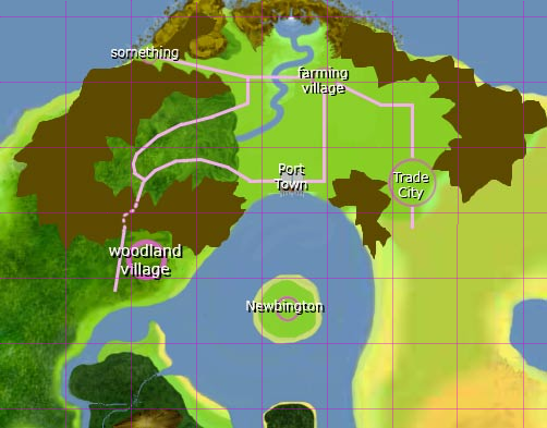
Dabe: Could you maybe modify the area around Hurnscald (the woodland village) a bit so that it fits the already created maps? Just as much as necessary (moving the small bay south of it a bit south, the eastern part of the mountain ridge a bit north and the woodland village mark to the center of the cell).
Here is the source file:
http://www.crushnet.org/TempFiles/tmw/A ... opment.xcf
Here is an older overview map (not including Hurnscald): http://wiki.themanaworld.org/index.php/ ... ndplan.png
You can ignore all the water areas. It is not a problem to "fill" them with new land. But I would not like it much when a lot of the walkable area of the maps would be lost because I invested much work into them.


